- Sensors and monitoring
- Risks and outages
Satellites, artificial intelligence and hyperlocal sensors are changing how wildfires are monitored and how risk is managed on transmission lines.
Resilion4 min read
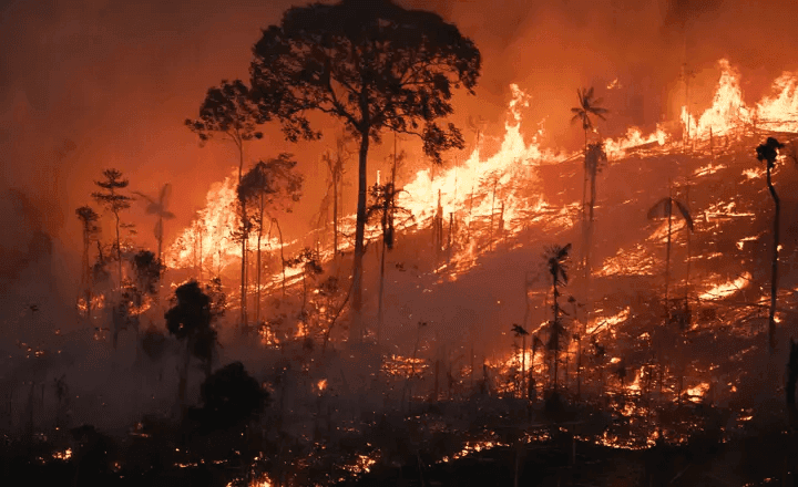
The winter of 2026 is pitting two distinct weather regimes against Brazil's transmission grid. In the South, successive cold fronts bring storms and strong winds. In the interior of the Center-West, Minas Gerais and Tocantins, the peak of the dry season pushes temperatures up and relative humidity down. With El Niño strengthening and forecast to reach moderate to strong intensity in the second half of the year, those conditions are likely to last.
That sets the stage for brush fires and wildfires. For transmission operators, fire is more than an environmental threat. It carries a direct financial cost. Every forced outage triggers a Variable Portion (Parcela Variável) deduction from the Permitted Annual Revenue (RAP), and the cost grows with the length of the outage, before counting structural repairs, emergency crew mobilization and regulatory exposure.
Why does fire take lines down?
Fire does not have to touch the tower to trip the line. Flame and smoke passing beneath the conductors is enough. Soot and heated air lower the dielectric strength of the air gap, causing flashover and a forced outage.
At the same time, heat expands the conductor and increases sag, cutting its clearance to the ground at exactly the wrong moment. After the fire has passed, the soot left on the insulators keeps the risk high until the first rain. In severe cases, thermal stress also causes direct structural damage to foundations, steel members and OPGW cables.
At Resilion, we believe managing this risk has to go beyond generic weather monitoring. We use the IPCC risk framework to quantify the real danger on each stretch of the grid:
- Hazard: The fire detected by satellite and its potential to spread, based on wind speed, relative humidity and the fuel load in the surrounding area.
- Exposure: Which structures and line sections lie within the plausible path of that smoke or flame over the next few hours.
- Vulnerability: How well that specific tower and its right-of-way can withstand thermal stress, given the state of vegetation clearing, the structure type, conductor-to-ground distance and incident history.
The technology frontier in monitoring
Wildfire monitoring has moved on from historical analysis to integrated systems that combine remote sensing, artificial intelligence and edge computing to deliver operational answers. The technologies already on the market rest on five core pillars:
- Satellite Monitoring and Artificial Intelligence: data from the Queimadas Program run by INPE, Brazil's national space research institute, is integrated to map burned area daily, instead of the monthly reports that used to be the best available.
- High-Frequency Thermal Satellites: coverage is filled out with data from operators of dedicated infrared constellations, such as OroraTech, which runs fire detection on board its satellites. This sharply reduces alert latency and covers the afternoon window, when fire activity peaks and public satellites pass over less often.
- Digital Twins and Predictive Modeling: the aim is to anticipate how the fire will behave. Fire danger models combine temperature, humidity, wind and accumulated precipitation to project the probability of ignition over the following days. On an hourly scale, spread simulations map the path of the flames, guiding preventive de-energization and the dispatch of field crews.
- Edge Sensing and Hyperlocal Data: the satellite tells you where the fire is; the edge tells you how the tower is reacting. Weather stations are installed on critical towers to track local conditions more precisely, along with AI-enabled cameras (computer vision) that spot fires near the line with high accuracy.
- Risk-Based Maintenance: historical data on fire-related outages, climate studies, terrain characteristics and other variables feed predictive failure models that can inform decisions on maintenance priorities. This kind of maintenance planning, which weighs risk (probability of failure x impact), is called Risk-Based Maintenance (RBM).
Strategic benefits
This multidimensional approach lets utilities move from a reactive posture to management driven by actual risk.
Smarter maintenance lets companies drop fixed schedules for vegetation clearing and right-of-way maintenance. OPEX goes exactly where the risk of fire is imminent and the fuel load is critical. With real-time monitoring, operators can apply the right operating procedures and trigger contingency plans.
Operating blind in regions with heavy biomass loads and sparse weather data is an unsustainable financial risk. Hyperlocal, integrated data is the only way to turn the unpredictable into operational resilience.